Multi-Spectral NDVI Imaging
Droneworks New Zealand offers a Multi Spectral Imaging service to the precision agriculture industry. We use a scientific grade sensor to provide the highest quality results possible. In a nutshell, this service can quickly and accurately pin point any stressed areas in your crop, field, vineyard, orchard etc even before there is any visible sign to the human eye. This allows you to take direct, localised action to non performing areas. This technology can be applied to any form of plant life.
What is Multi-Spectral imaging?
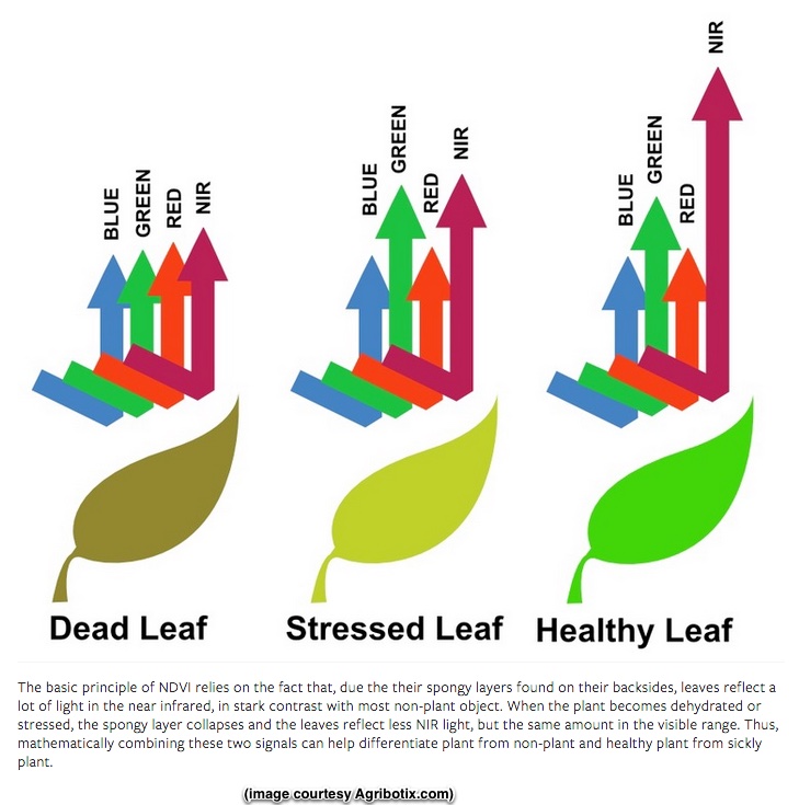
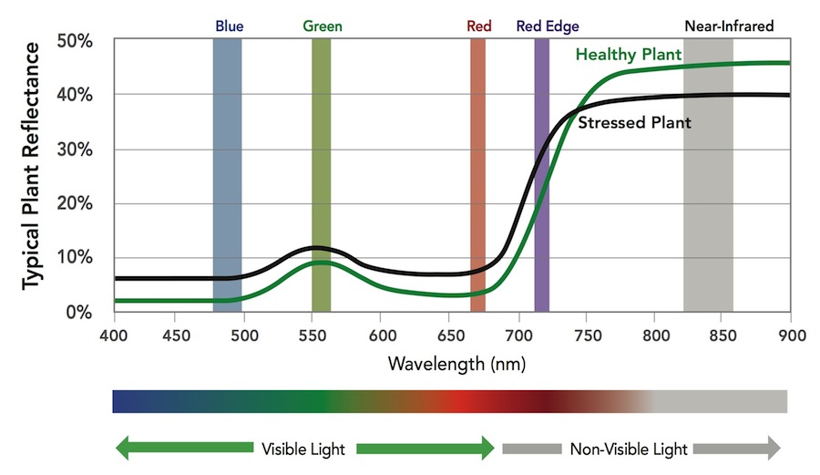
The colours we see in light are defined by the wavelength of that light. Plants absorb and reflect light differently depending on this wavelength. Plants typically absorb blue light and red light, while reflecting some green light. They also reflect a much larger amount of near-infrared (NIR) light, which is not visible to the human eye but is visible to multi-spectral cameras like the ones fitted to our drones.
By measuring the reflectance of a plant at different wavelengths, multi-spectral imaging enables identification of areas of stress in a crop, and provides a quantitative metric for the vigour of a plant.
How do Multi-Spectral cameras work?
Multi-spectral cameras work by imaging different wavelengths of light. Professional multi-spectral cameras have multiple imagers, each with a special optical filter that allows only a precise set of light wavelengths to be captured by that imager. The output of the camera is a set of images for that particular wavelength. These sets of images are then stitched together to create geographically accurate mosaics, with multiple layers for each wavelength. Mathematically combining these layers yields vegetation indices. There are many types of vegetation indices that measure different characteristics of a plant.
Some indices are useful for measuring chlorophyll content of plant leaves, which can provide a reliable indicator of nitrogen status and help inform fertilizer management decisions. Other indices can be used to estimate the amount of leaf area per unit ground area (leaf area index) and help identify within-field differences in crop development or vigour. One popular index is the Normalized Differential Vegetation Index (NDVI), created by combining the reflectance from red and NIR light.
How do professional Multi-Spectral cameras differ from Single-Imager Multi-Spectral cameras?
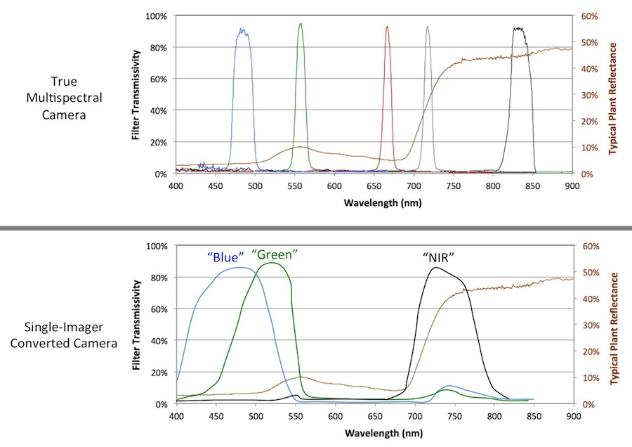
A single-imager multi-spectral camera uses a blocking filter combined with the standard camera's built-in filter to capture information in 3 wavelengths of light. Because these imagers aren't optimized for remote sensing, the built-in filters are wideband and suffer from data contamination from neighbouring bands.
A professional multi-spectral camera like the Sequoia uses narrowband filters with known characteristics combined with factory calibration parameters, enabling accurate measurements of reflectance that a converted camera simply cannot match.
If you would like to learn more about multi-spectral NDVI imaging and data processing please visit www.micasensense.com