• Home
  • About Us
  • Real Estate
  • Property Developers and 3D Renders
  • Cinematography
  • NDVI Mapping
  • Flying a Drone in Queenstown
  • Contact
  • Gallery
  • Clients
  • Mapping
  • Photography
  • Terms & Conditions
  • NDVI For Vineyards
  • Aerial Inspections
  • Marketing and promotional films
  Droneworks New Zealand
Picture

Mapping Services

Picture

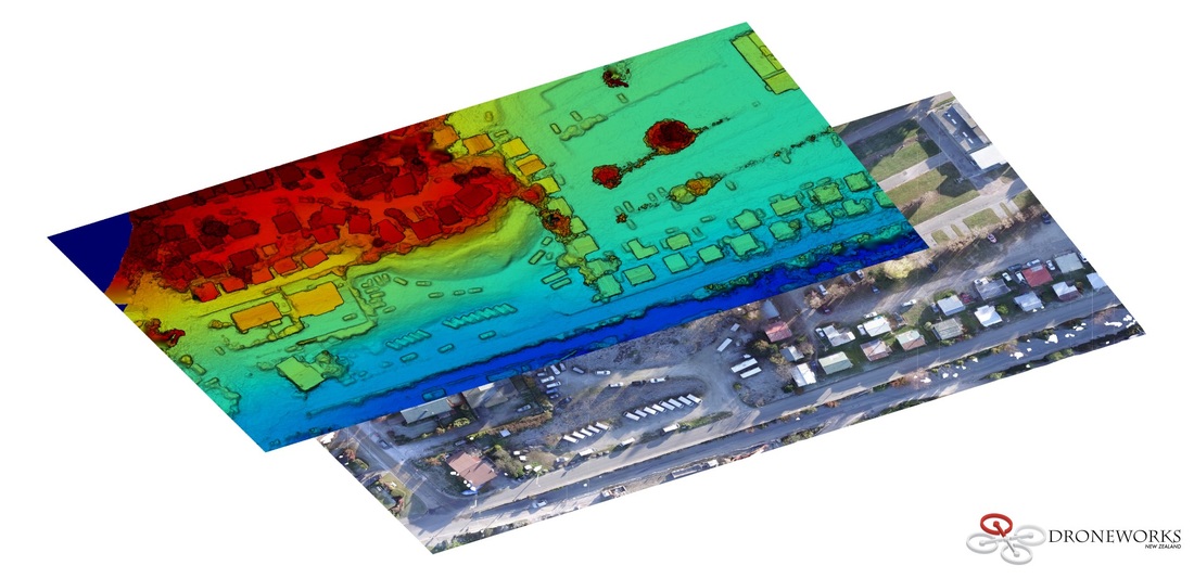
2D High Resolution Mapping

Talk to us today about how UAV Mapping can help your business or project.
  • Useful application examples:
  • Work sites
  • Survey
  • Farm G.I.S
  • Construction Progress
  • Land Development
  • Site Planning
  • Volumetric Data Gathering
  • Terrain Elevation Mapping
  • Environmental Monitoring
  • Agricultural Inspection
Picture
Enquire Now

Services

Real Estate
Property Developers
3D Rendering / Plate Shots
Cinematography
Mapping
Agricultural

Company

About
Clients
Gallery

Support

Contact
FAQ
Terms of Use
© COPYRIGHT 2016. ALL RIGHTS RESERVED.
  • Home
  • About Us
  • Real Estate
  • Property Developers and 3D Renders
  • Cinematography
  • NDVI Mapping
  • Flying a Drone in Queenstown
  • Contact
  • Gallery
  • Clients
  • Mapping
  • Photography
  • Terms & Conditions
  • NDVI For Vineyards
  • Aerial Inspections
  • Marketing and promotional films